April 15 – April 16, 2018.
Sometimes you just have to see it for yourself. In the 1950s the Department of the Interior was petitioned to protect the canyonlands. The effort didn’t gain much traction, though, until Interior Secretary Udall flew over the area in 1961. Luckily, it was during the day and he could get a good view. He pushed, and in 1964 President Johnson signed legislation naming it a National Park.
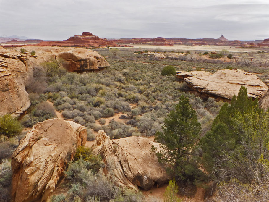
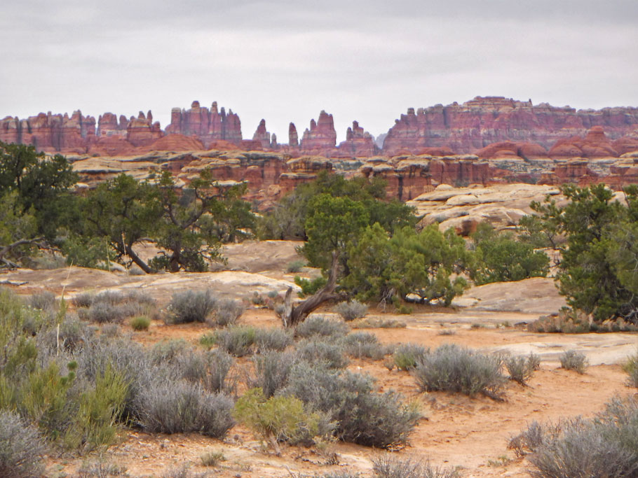
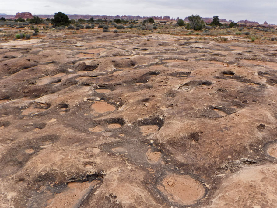
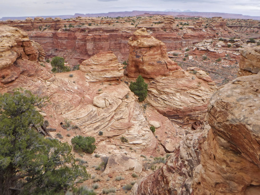
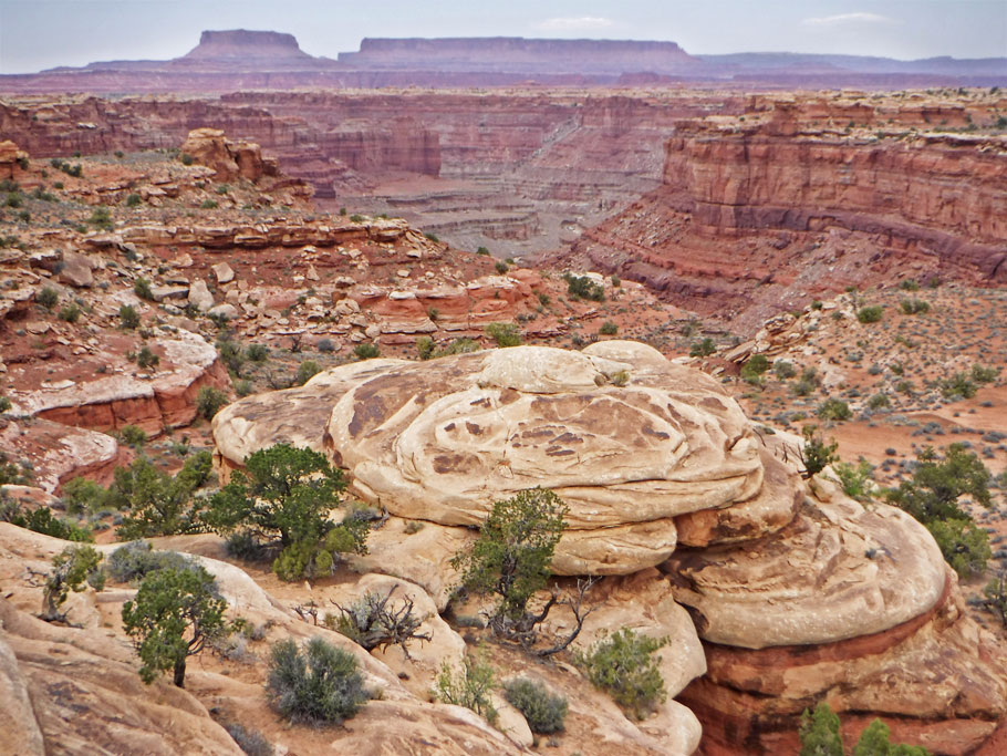
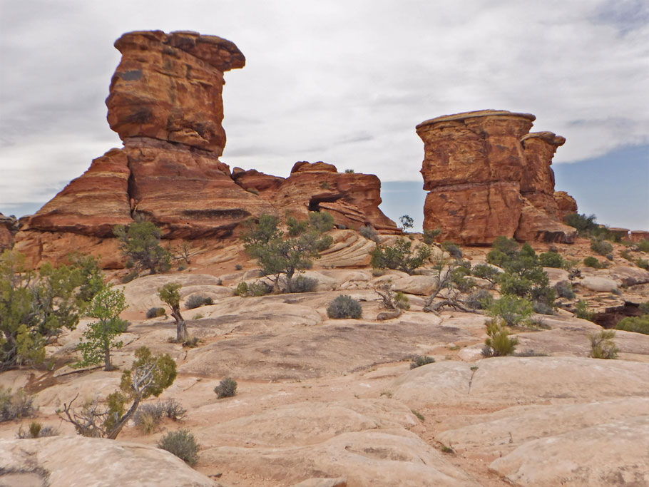
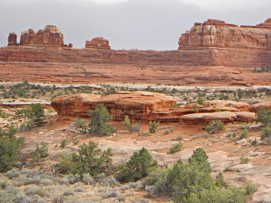
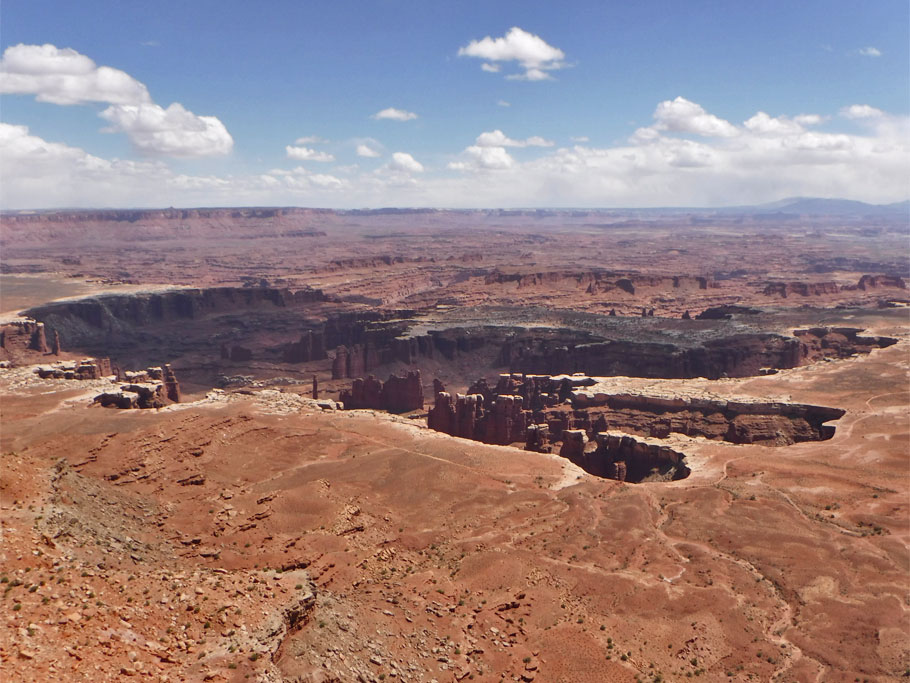
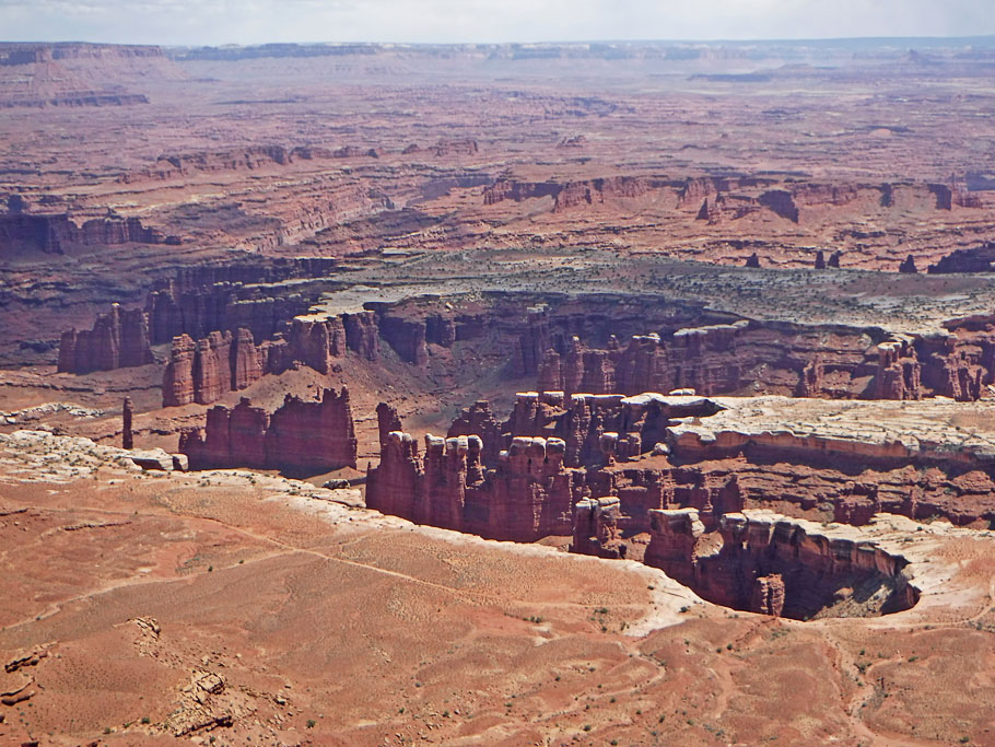
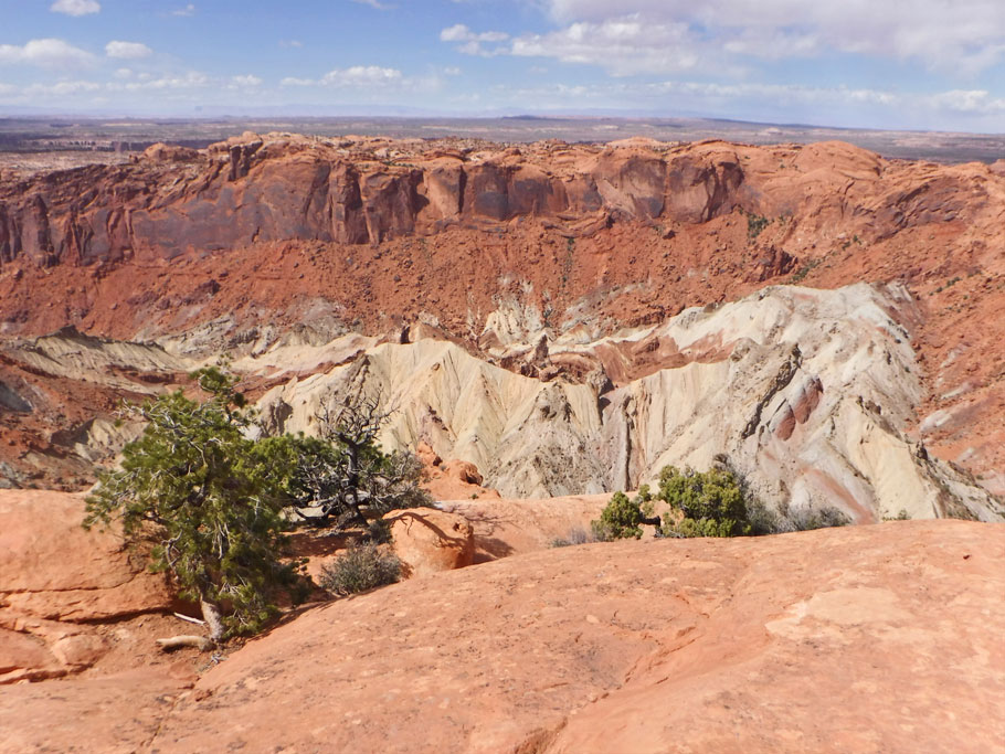
Canyonlands is all about erosion in the Colorado Plateau*. This erosion is a recurring theme in many of the posts we need to catch up on from last year. So I wrote up my own condensed history of the plateau below. The scenery here is special because it’s where the Green and Colorado rivers meet.
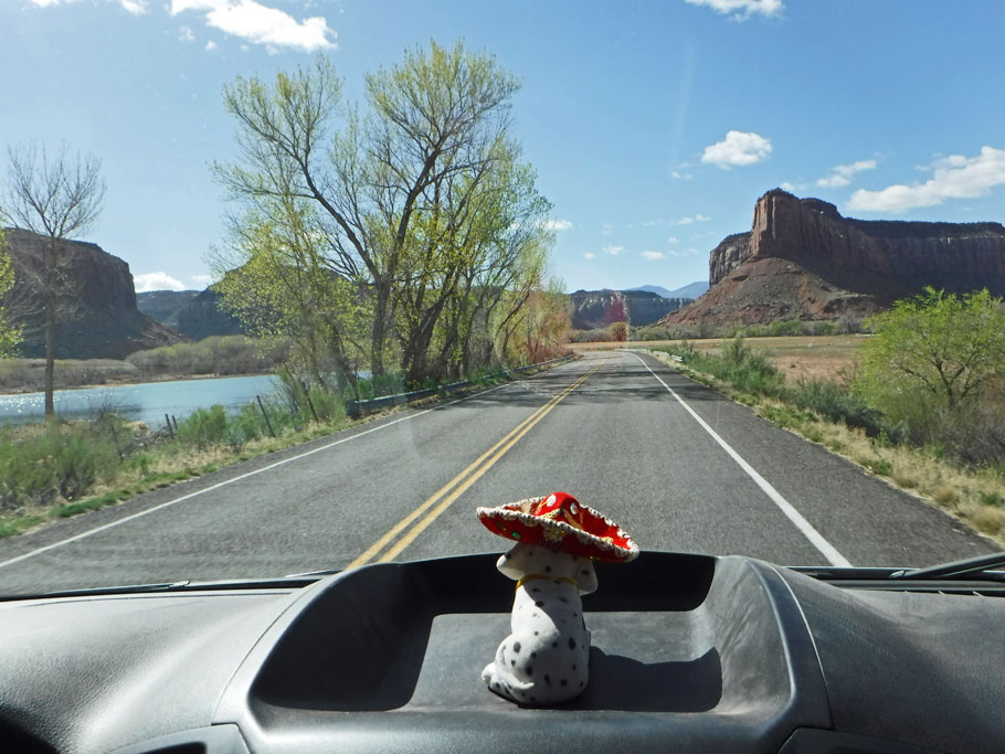
Most of the land area can only be accessed by 4-wheel drive, horseback or on foot. You can also float on the rivers. We drove through the southern entrance, and saw what we could. Then we drove another hundred miles to the northern entrance. Hopefully someday we’ll be back with 4-wheel drive and kayaks.
Colorado Plateau
The Colorado Plateau don’t get no respect. It did hundreds of millions of years ago when it was beachfront near the equator. Yes, the ocean receded, but it always came back. Then slowly things changed. It got pushed northward and upward. New species were born. Others died out. Layers of sediment accrued. Some were washed back off. It was swampland. It was sand dunes. The processes happened over and over until it was finally put on a shelf over a mile above sea level, stuck where Utah, Colorado, Arizona, and New Mexico meet.
And does anyone want to see it? Oh, they string barbed wire all over and let cows poop on it. But no one comes to watch the dust blow back and forth across the arid surface.
People do like to watch the rivers cut through all that sandstone, though. Perfectly good ancient desert, and people just want to see the parts that are eroding away.
(If you want more detail, there are sources that will tell you about the dozens of unique layers of sandstone, and about the unconformities — layers that were washed away before new ones were put down.)
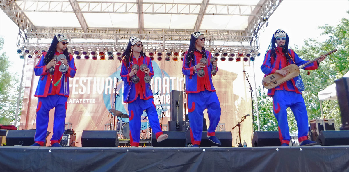 Right now, this very minute, we are hanging out in our friend, Brenda’s house in Hobe Sound, FL. We have both had our first showers since we were in Mexico – not that we haven’t been keeping clean, but a shower is amazing and such a different experience from scrubbing up in the van with a wash cloth. Our trip back to Florida was long and mostly uneventful except for a stop in Lafayette, LA to meet up with Duwan’s niece at Festival International. Now on to boat stuff and wrapping up a few more blog posts from our adventures out west.
* All pics are click to enlarge.
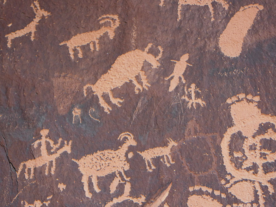
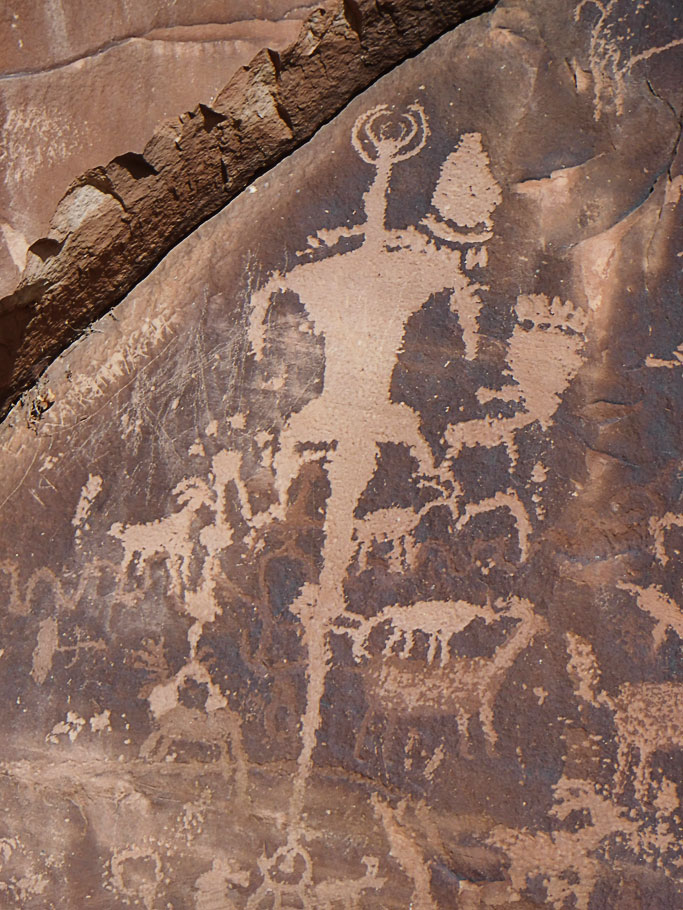


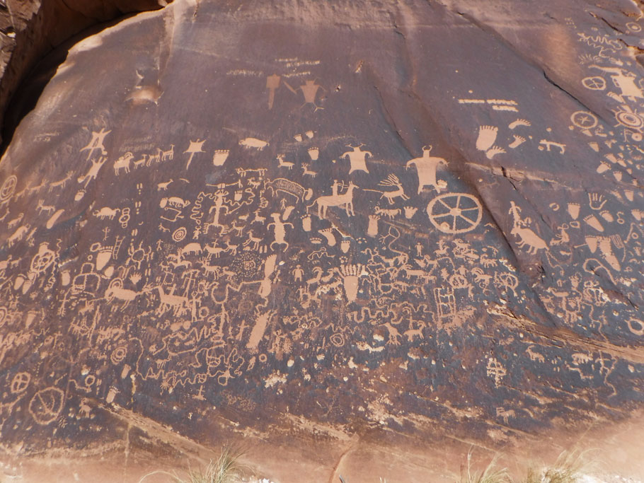
I remember seeing Newspaper Rock. I’m loving these posts cause they remind me of our southwest adventures. So much to see out there that you could spend a lifetime there and still not see it all.
I think we could travel in circles on the same routes 10 times and still not see it all!