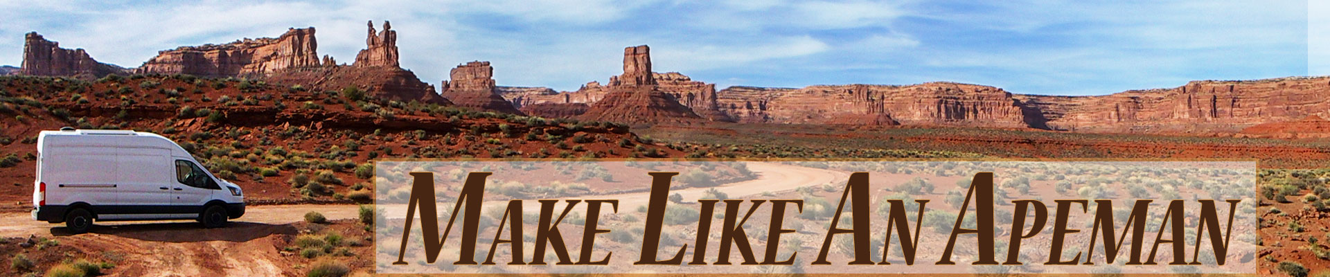
April 14 – 19, 2019.
It rained for almost a whole day while we were in Kanab, Utah. Usually, we might head on. One of the things we love about van travel is the ability to just easily move away from bad weather. But we were in Kanab for a purpose, so we stayed put and spent the day in the library.
It was a small library and I overheard another visiting patron complaining to the librarian. “I hate it, Kanab is getting to be too popular, it’s turning into the next Moab.” Moab, nestled between two national parks, a state park and surrounded by a lot of public land, free camping and dinosaur tracks, is one happening little town. But although Kanab has public land too, a few dino tracks, and spots of free camping, it doesn’t have the big draw of being crazily close to two major National Parks like Moab. But what it does have is The Wave Lottery. And this is why we were sitting out a day of rain in a library in Kanab, Utah.
Located in the Paria Canyon-Vermilion Cliffs Wilderness Area at Arizona’s northern border with Utah, The Wave is an amazing landscape of rock that appears to be sculpted into giant undulating crests of water. Actually, it’s Navajo Sandstone from the Jurassic age that was once formed by rain runoff but is now sculpted by the wind. This erosion has “exposed large-scale sets of cross-bedded eolian sandstone composed of rhythmic and cyclic alternating grainflow and windripple laminae.” – well, at least that is what Wikipedia tells me. No matter what the wave is or how it was formed, the point is it is really really cool and everyone wants to see it.
The Wave used to be a big secret, known only to locals, but then the word got out and people started coming from all over the world to hike these unusual formations. So many people started to come that in the late 1980’s the U.S. Bureau of Land Management (BLM) who manages the public land where The Wave is located started requiring permits to access the area (issuing those permits by lottery) to comply with the Wilderness Act, which requires that protected areas have “outstanding opportunities for solitude.”
There are only 20 permits issued per day and two ways to enter the lottery – online or in person at the BLM visitor center in Kanab, Utah. Since we never know when we will be where we skipped the online lottery (which must be entered 3 months in advance of your desired hike date) and traveled to Kanab where we would try our chances only one day in advance. We had entered the lottery in Kanab once the year before and another time the year before, but were determined this year to enter the lottery each day until we won or our desire for surfing this stunning sandstone waned.
Showing up in person for the lottery also gave us the best odds of winning. Thousands of people vie for the 10 daily online slots as opposed to mere hundreds who compete in person for the other 10 available slots. The lottery is so popular that in 2017, more than 160,000 people applied for the year’s 7,300 permits, 20 percent more than the previous year. Apparently, the demand has grown so large that the BLM is considering increasing the number of permits issued each day from 20 to 96!
We gave the lottery 4 tries, competing against 138 people on the first day and losing, 200 on the second and losing, 155 on the third and losing, and 168 on the fourth – and – losing yet again!
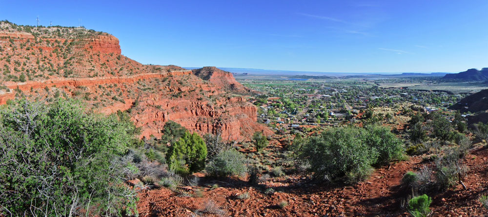
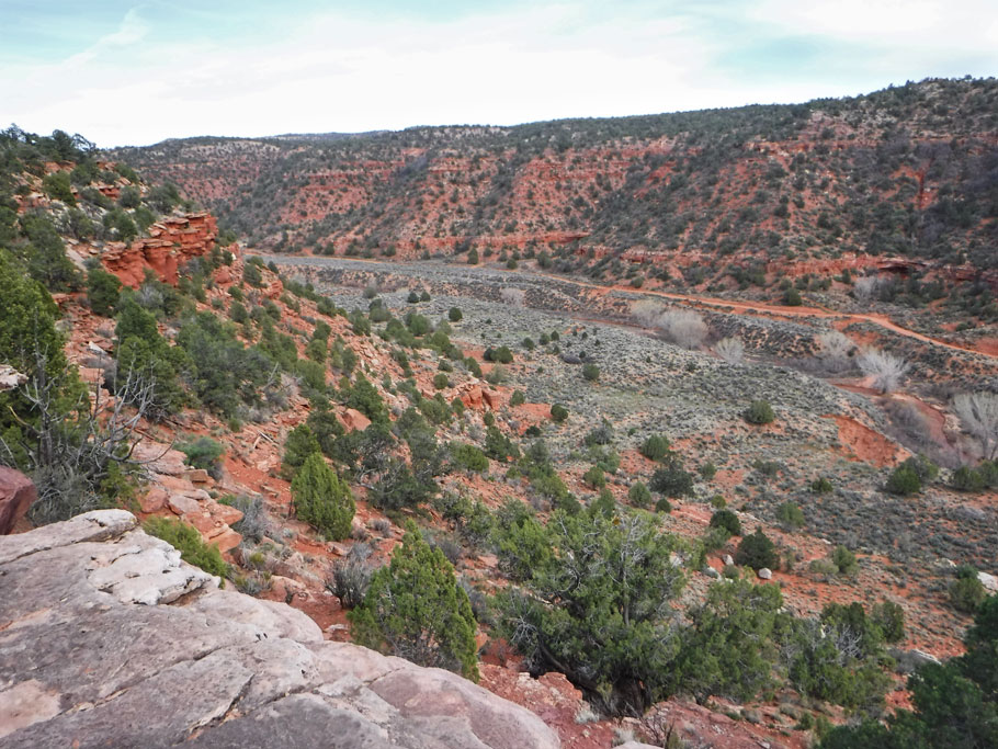
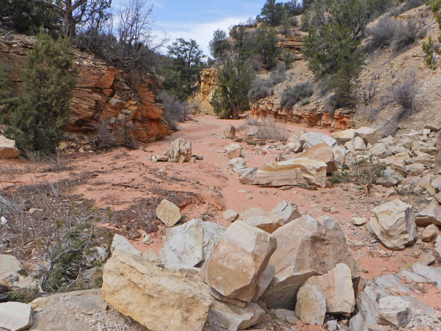
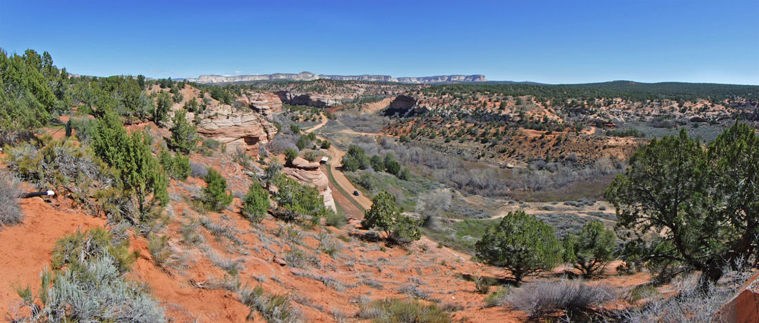
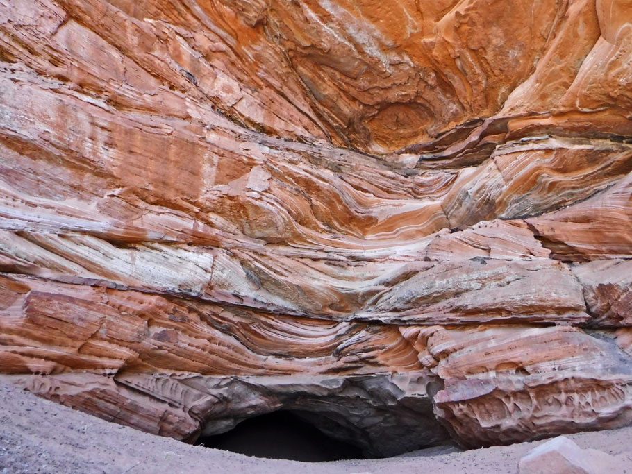
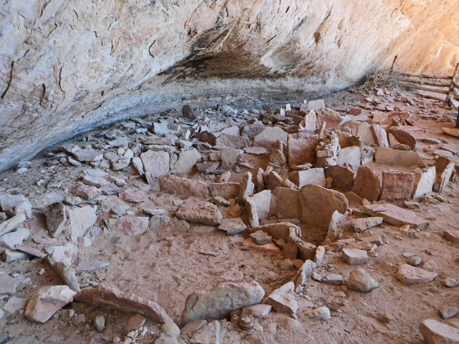
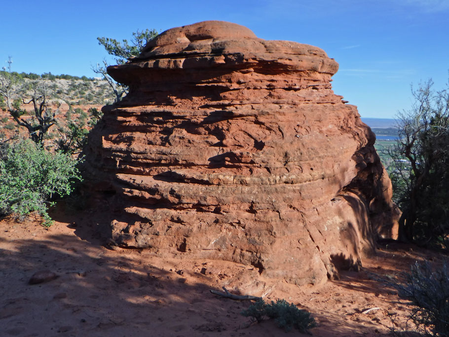
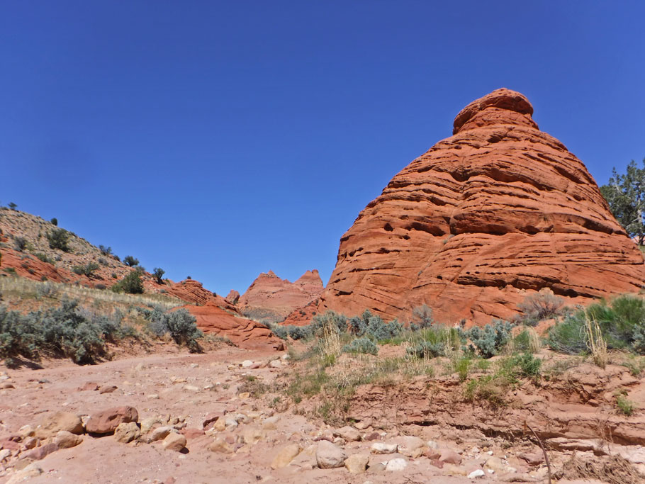
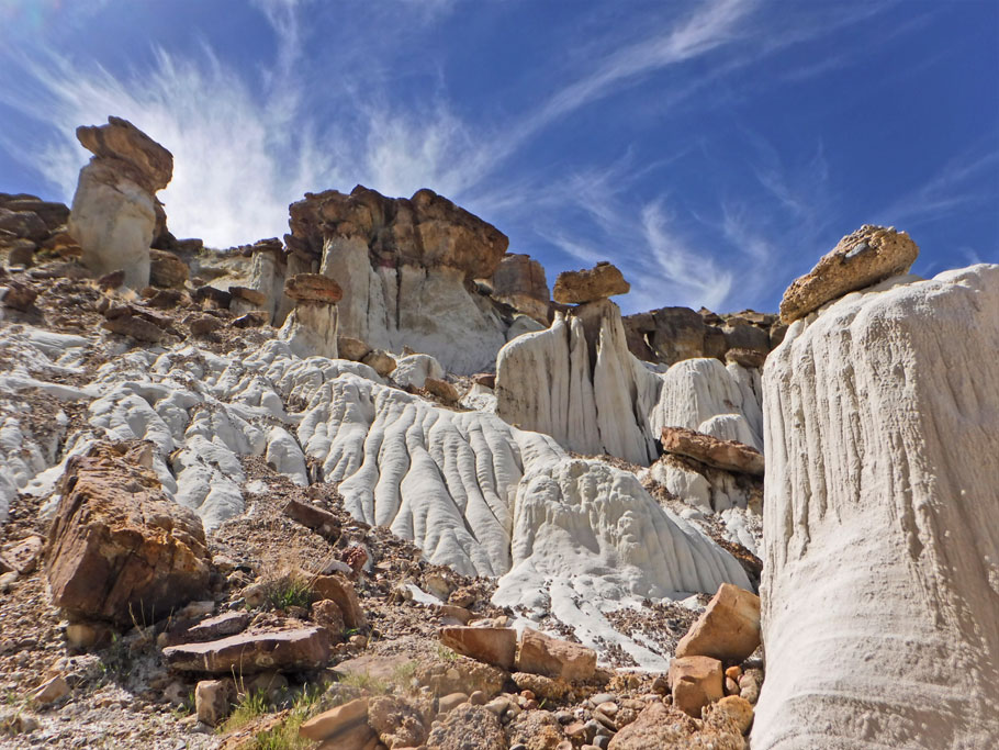
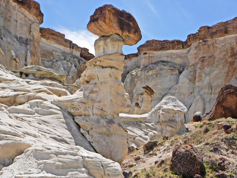
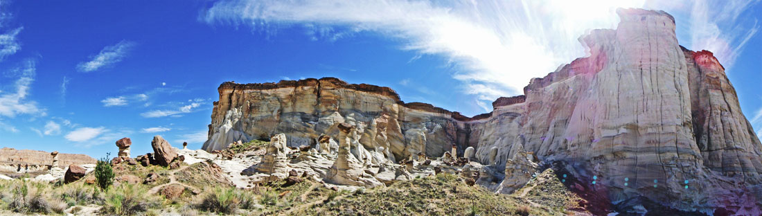
But Utah never disappoints – and although I’m sure the Lottery is one of the big things drawing so many more people to Kanab each year, it is not the only thing Kanab has to offer. Over the 6 days we spent in the area we found a different place to camp each night, went on numerous hikes and saw lots and lots of amazing rocks in the shapes of toadstools, a white goddess, beehives, and dinosaur tracks, we hiked to an underground cave, climbed over cliffs overlooking the city, and squeezed through narrow canyons, and every morning at the lottery we got to join hundreds of adventurers just like us looking for the next cool rock to photograph, walk on, and marvel at in the fascinating landscape of southern Utah.
I hope you enjoy the pics of all the other hikes we did around Kanab, but if I have your curiosity piqued about the wave, check out my friend’s blog about winning The Wave on their very first try!
And BTW – if you think you want to travel to Kanab and try for the Wave click here for an excellent resource for other hikes and things to do on lottery days.
* Click pics to enlarge and open into a slide show.
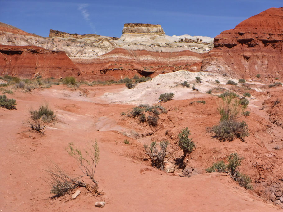
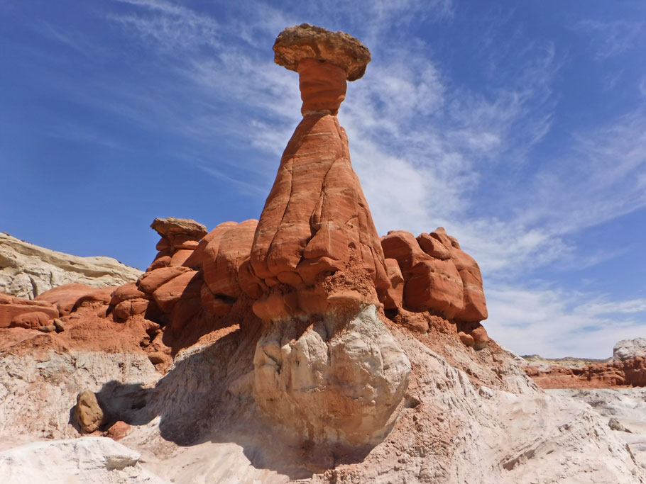
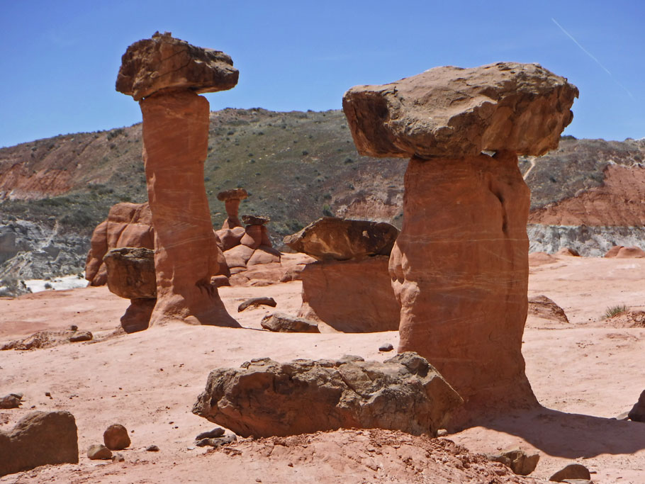
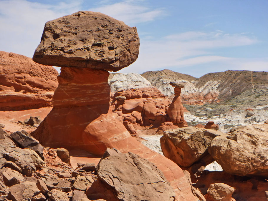
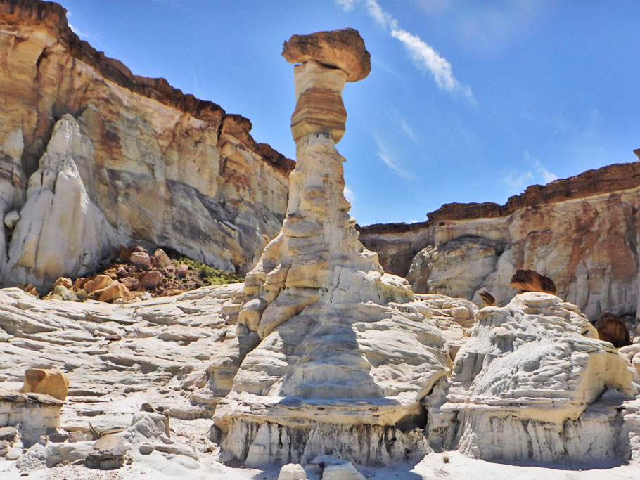
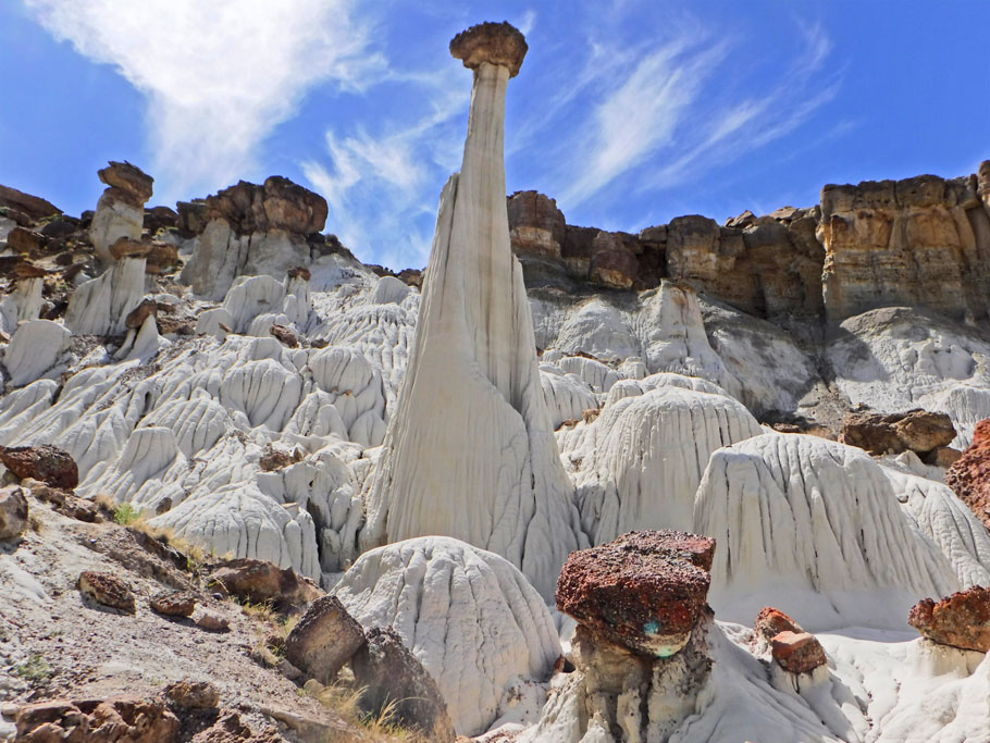
Toadstool Hoodoos
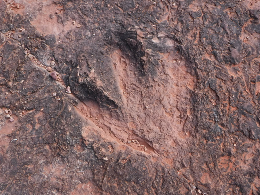
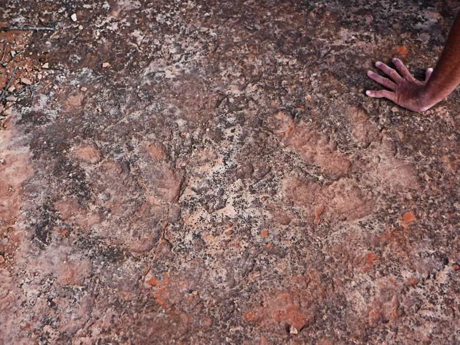
Dinosaur Tracks
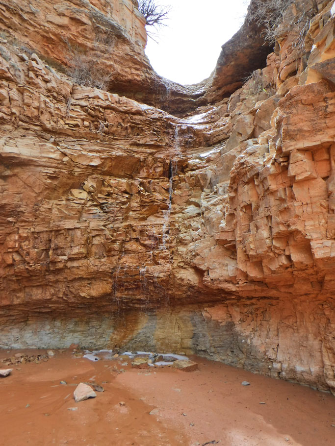
Belly of the Dragon


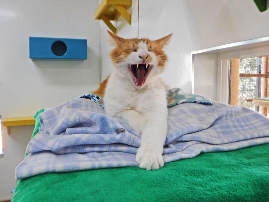
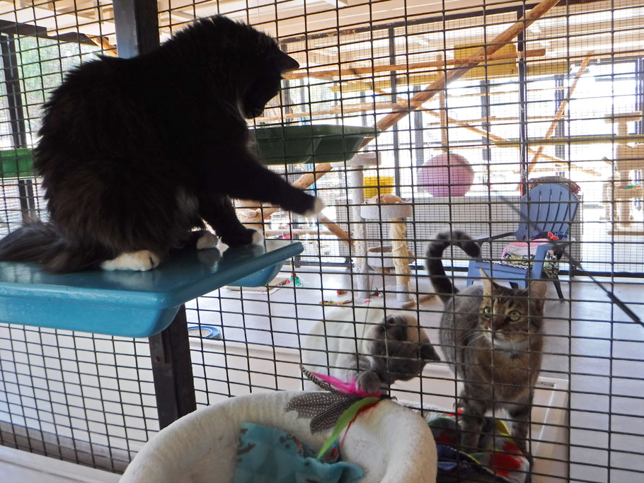
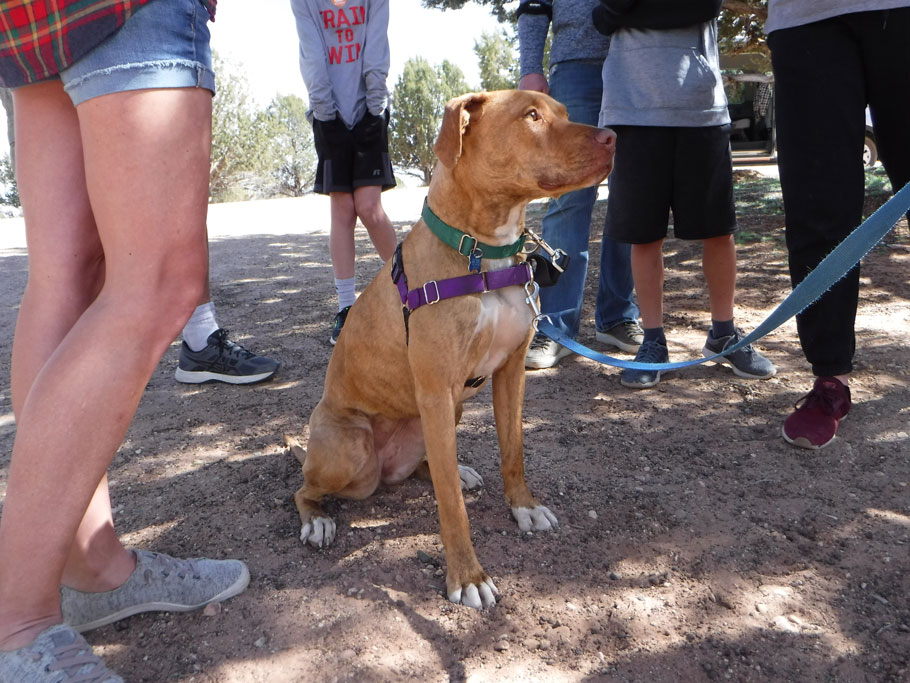
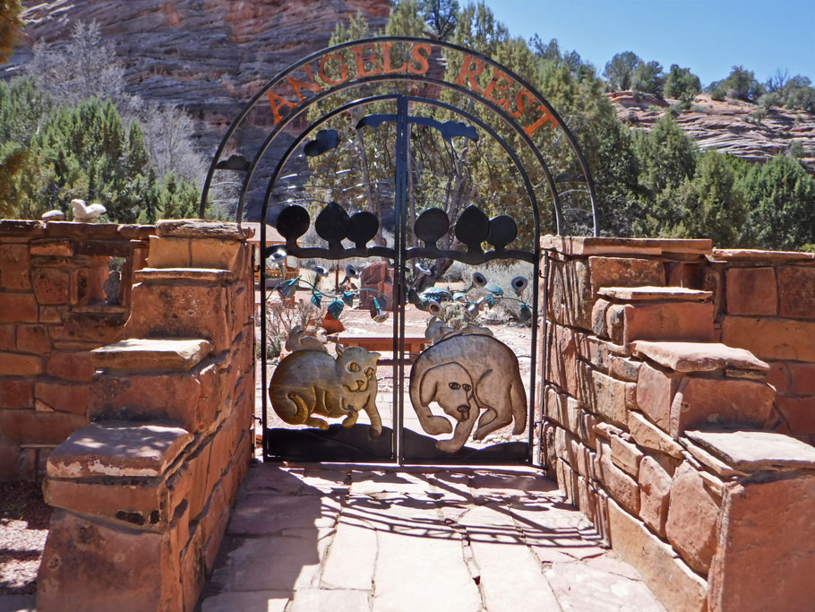
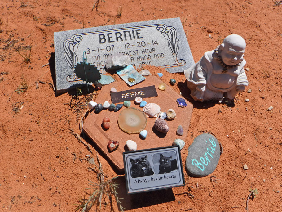
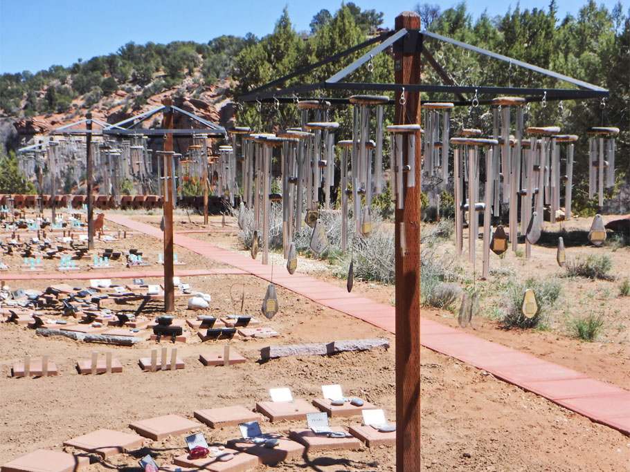
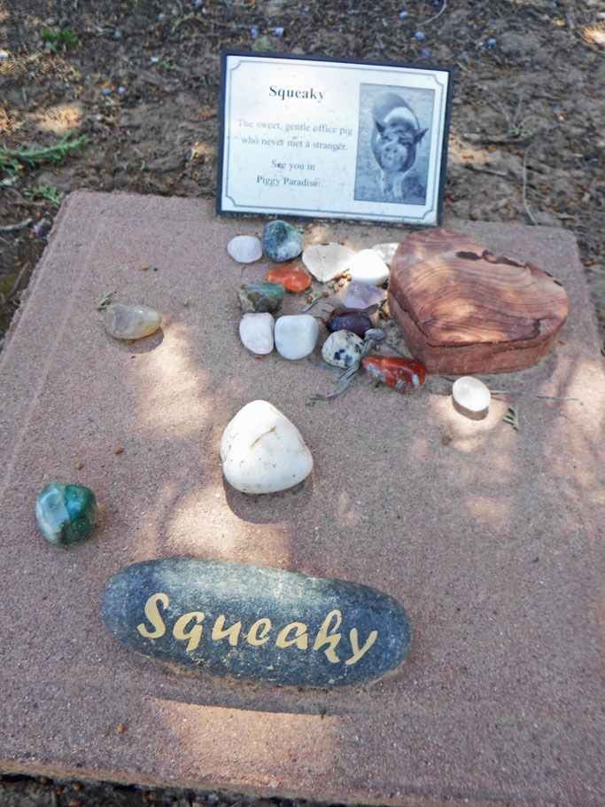
Best Friends Animal Society
Best Friends Underground Cave Hike
Squaw Trail

Wire Pass
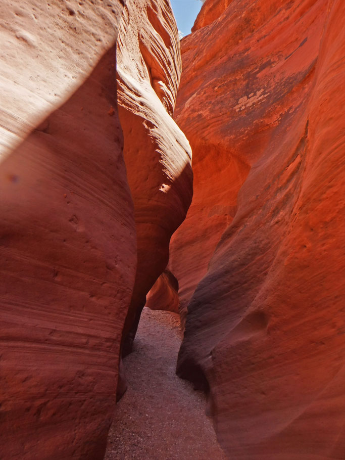

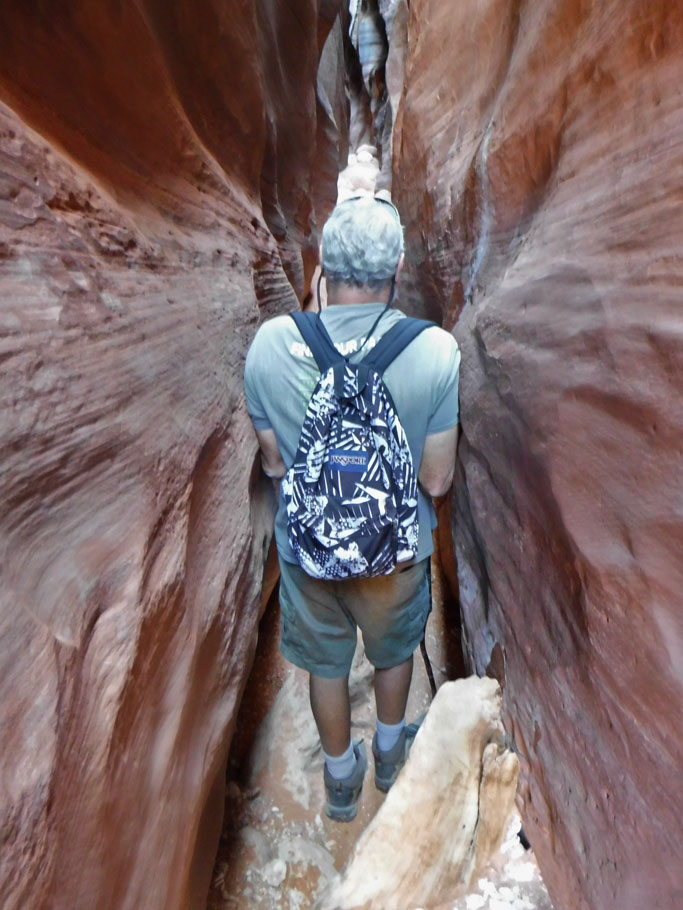
Buckskin Gulch


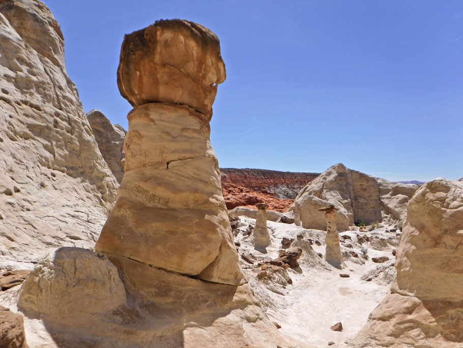
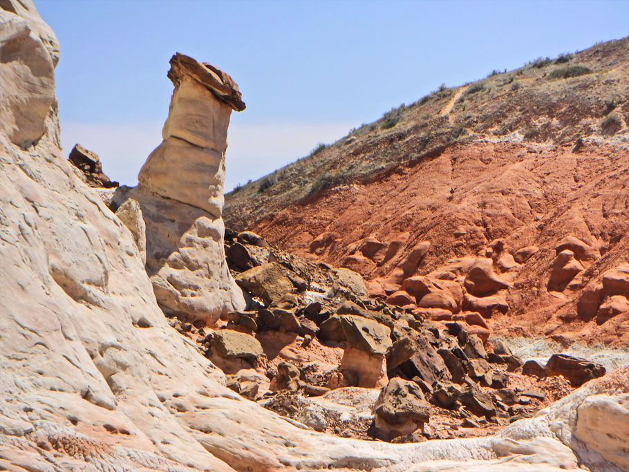
Wahweap Hoodoos


Always interesting! I think the second picture looks like your spotted dog that sits on your dash…complete with a hat!
Thanks!
Bob as sculpted in nature. I like it!
Thanks for sharing. I was hoping you would win a pass so you could share photos. Wire pass looks awesome.
Us too! Perhaps we will try again next year – especially if they increase to number of permits – although I fear more permits will mean more difficulty getting photographs without people in them.
Hoodoos and dinosaur footprints are all well and good, but cats (!!!) and dogs (!) and a pet cemetery (!), now that’s awesome!
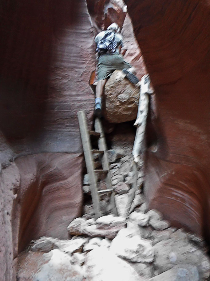
How did Greg make it through some of those passages? I wouldn’t have been able to do that climb without that ladder. The two of you must be so fit with all of these hikes you’re doing.
The pets really were awesome. It was one of those things that ended up being so much more fun than I thought it would be. The pet cemetery was the best! I have tons more pics. It is so cool to see what tokens people leave for their pets.
That climb was very nearly impossible with the ladder – and a lot harder going down. We encountered it at the same time as a few other groups – Greg went first and I went second. There was no way to see where my feet were going. People from the other group held on to my arms until I got my footing.
Wish we were fit! I keep telling myself that once we get down to a lower elevation I’ll be able to hike without so much heavy breathing.
Your photos are stunning, Duwan! The cat one at Best Friends is classic. What a great overview of things to see and do in the Kanab Area. I will reference your blog next week, when we will be there for a little while. Although, Mark’s diligent checking of the volunteer schedule (3X a day) means that almost all our days have been filled with one or two shifts. 🙂 We start on Friday.
Thank you for the mention/our link in regards to The Wave. I can’t believe they’re thinking of increasing the number of permits. It would get crowded! I agree they have to do something, though, since the odds are so small and so many people get disappointed every day. Maybe they can put in time slots, so the Wave and surrounding area won’t be “flooded”.
We saw a photo today at an Inn souvenir shop, with water rushing through the Wave. How he managed to capture that photo remains a mystery to us!
Enjoy your trip east!
We took a day off from the lottery because it was going to rain the next day – perhaps we shouldn’t have – we could have won and gotten a pic of water rushing through the Wave too! But, I don’t know – I wonder how much it actually has to rain for that to happen? Not sure I want to hike in that much rain for a picture.
Even though I like the idea of raising the number of permits, I think 96 is too many – but I assume there is some reason for that exact number.
I hope you have a good time with the pets next week!
Amazing blog post, such interesting places to check out and the dinosaur tracks. I’ve never been there but it’s on my list. 🙂
Thanks Tina! I bet your list is amazing! Glad I could add to it.