
July 3 – 6 & September 3 – 7.
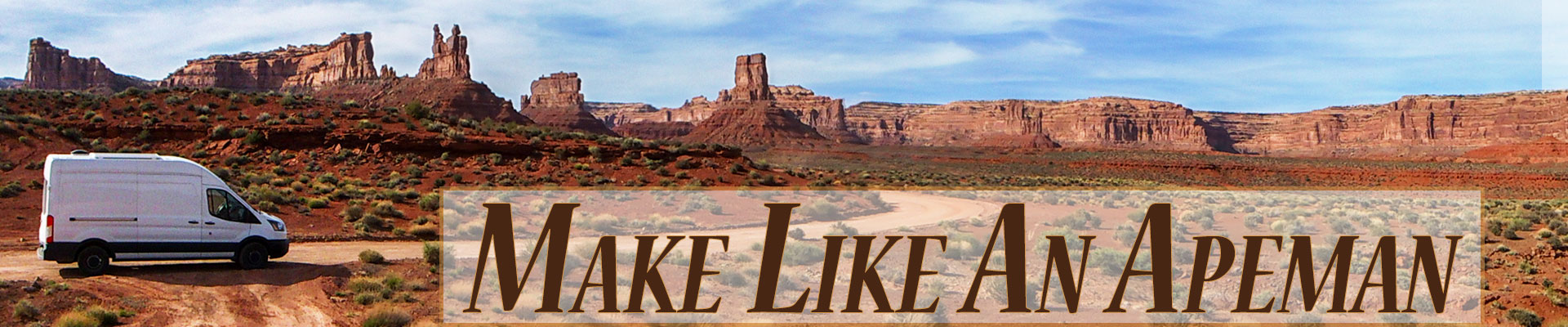
After the Canada Day Parade, we left Stewart, BC, and continued our travels north to the Alaska Highway. Once we reached the highway we could have headed west and made a beeline for our ultimate destination, Alaska, but we made yet another small detour, turned right, and drove about 13 miles east to Watson Lake.
Watson Lake Sign Post Forest
Watson Lake is a small town with a couple of tourist attractions – one being one of the most famous stops along the Alaska Highway, The Sign Post Forest.
The Alaska Highway was built in 1942 to connect the lower 48 to Alaska. Prior to this road, the only way to reach Alaska was by boat or airplane. Although the idea of such a route had been tossed around since the 1920s, it wasn’t until the Japanese bombed Pearl Harbor and briefly invaded a couple of the Alsakan Aleutian Islands that all parties involved agreed to start construction.
During the building of the highway, a bulldozer damaged a directional signpost that pointed out various locations in the region. Private Carl Lindley, of Company D, 341st Army of Engineers was tasked with repairing the sign. But when he did so he added an additional location and arrow pointing to his hometown of Danville, Illinois. Soon others added signs pointing to their hometowns. Lindley’s original sign is gone but today there are over 77,000 placards on poles and trees in the forest. I wanted to add one more.
Across the parking lot from the forest is the Watson Lake Visitor Center. There we found a super friendly and helpful staff. The visitor center provides painting supplies for making signs but not wood (which, apparently you can buy somewhere in town). Luckily we had some leftover scrap wood from previous van projects.


After we made and posted our sign we watched a good video about the history of the Alaska Highway at the visitor center and talked to one of the visitor center staff about what we should see next. She gave us lots of great ideas. So despite our ever-growing issue with Ballena Blanca’s power steering fluid leak, we decided we continue playing tourists. We turned onto the Alaska Highway heading west armed with brochures and suggestions from the visitor center lady.
First stop, a nice rest area with a beautiful waterfall.

Museums
George Johnston Museum
We weren’t really sure we wanted to stop at the George Johnston Museum in Teslin, Yukon. George Johnston sounded very anglo-Saxon. His name brought to mind some pioneer guy who journeyed to Northwestern America to make it rich by panning for gold. And for us, pioneer stuff can just be kind of boring. But George Johnston didn’t come to this area to acquire riches, he was born here as a member of the Tlingit First Nations.
And he was a pretty interesting guy! He was a fur trader, entrepreneur, and photographer. He owned the first car in the area – before there were even roads. He had the car shipped from Whitehorse and it arrived on a boat. He’d charge people for rides. In the winter he’d paint the car white and drive it across frozen lakes. And he documented his life and the life of the indigenous community around him with his camera.
I loved this museum, especially Johnston’s photographs. Besides the displays, the museum also showed a movie about Johnston’s life where we learned more about the Alaska Highway and its impact (not good) on the indigenous population.


Teslin Tlingit Heritage Centre
The Teslin Tlingit Heritage Center, also in Teslin, is not far from the George Johnston Museum. As the name of the museum suggests, here we learned more about the Tlingit people and their culture. But unfortunately, they do not allow photographs inside the museum so I remember little about it. But across the parking lot from the museum is a little house where they have demonstrations. There we found a woman who made herbal remedies and did traditional beading. Although reserved, she was very nice, answered all our questions, and let us take a few pics.


Detour to the World’s Smallest Desert
After we left Teslin, we couldn’t resist making another detour – to see the Carcross Desert, the world’s “smallest desert.” We turned south off the Alaska Highway at Tagish Road which took us to the town of Carcross where we turned back north onto the Klondike Highway. Not far from Carcross, we found this diminutive desert.
The Carcross desert isn’t really a desert but rather one square mile of sand dunes. The dunes were formed when a large glacial lake dried up during the last glacial period. The mountains here create a rain shadow that keeps the sand dry but not dry enough to fit the definition of a desert.


Finally, Making Tracks to Alaska
After we left the Carcross Desert we needed to get serious about getting somewhere. Our power steering leak was getting worse and we really needed to stop driving around and address it. We drove back to the Alaska Highway and on to White Horse, the capital of The Yukon. There we crisscrossed the city looking for a mechanic but had no luck. We bought some more power steering fluid and decided to go ahead and get to Alaska.
As we got closer to the Alaska border, passing Klune Lake and Klune National Park and Reserve the beauty of this area of the Yukon dazzled us. But there was no stopping now. I told Greg we would need to explore this area on our way back. I even saw the perfect camping spot as we passed and I marked it on my map.


We followed the Alaska Highway across the border into Alaska to the town of Tok. I talk a little bit about Tok in this blog update. We would soon leave Tok and the Alaska Highway and head south down the Glen Highway to wait for our appointment at the mechanic. We wouldn’t return to the Alaska Highway until it was time to leave Alaska and head back to the lower 48.
Start of the Return Trip
On the 1st of September, we found ourselves in Fairbanks, Alaska. This is where the Alaska Highway ends and where the beginning of the end of Alaska adventure started. We were once again in a bit of a hurry. We had 27 days to get to Atlanta Georgia. So we decided on no detours and minimal stopping to take in the sights. This means, I really don’t have much to tell you about the part of the Alaska Highway that is actually in Alaska. We zoomed right by Santa Claus House in North Pole and all the other gift shops along this stretch of highway. We made one little detour to take in a view but it was too foggy to see anything. We kept moving and just enjoyed the scenery we could see outside Ballena Blancas windows.
We crossed the border and drove past Klune Lake, Klune National Park and Reserve, and the campsite on the lake I so wanted to come back to. We passed the turn-off to the Carcross Desert and the museums in Teslin, we spent the night at the Real Canadian Superstore in White Horse and then again at the Sign Post Forest in Watson Lake.


New Territory
South of Watson Lake things started to get interesting. We were in brand new territory! This was the part of the Alaska Highway we skipped on our way north. Luckily we didn’t skip it on the way back – it was amazing.
Less than an hour out of Watson Lake we saw one of those signs warning people of potential wildlife (Bison) on the road. We see those signs all the time for moose, deer, etc. but I honestly never expect to see any actual wildlife. And I have never expected to see Bison outside of a National Park. But before we knew it there was a herd walking along the road, right alongside our big whale, Ballena Blanca. Next, we would see caribou and bears!
The views were outstanding too. In the three hundred and nineteen miles that separated Watson Lake from the next town, Fort Nelson, only a few lodges and gas stations dotted the highway. The rest was pure scenery. Every stop we made was a picture postcard.


Eventually, we arrived at the beginning of the Alaska Highway in Dawson Creek, BC. We stopped for lunch, I snapped a picture of the iconic Alaska Highway sign, and we continued on our way. The vistas disappeared along with the wildlife. The roads became busy as we enter Alberta. More towns, road signs, traffic, and buildings dotted the map. We drove toward Edmonton. I saw an electronic billboard with a portrait of Queen Elizabeth. I turned to Greg and said to him, “I think the Queen died.” I checked the news. It was September 9th, she had died the day before. We were back in the “real” world. Cars whizzed by us on the highway as we left our Alaskan adventure behind.
But wait! How can our Alaska adventure be over? The blog has barely gotten there. Next time, the adventure starts!


You two made a really cool Cabbagetown sign! The little desert looked cute and very manageable for a walk. You sure enjoy your detours. 🙂
The best part of this blog – and I’m sure the Alaska Highway – was the last stretch with all the wildlife and picture-perfect scenery. Nice!
Yes, I think my favorite part of the highway was the stretch with the wildlife. I’m so glad we drove the whole highway on the way back.
Yeah, I think we have the best sign!
Great post, interesting history. I think your sign stands out, too! Such an amazing trip, great views.
Thanks Natalie! I love our sign.
Gorgeous and interesting photos. I have not been to Alaska yet. I have to visit one day.
Thanks Thomas. Alaska is very unique. I glad we got to go!
I’ve always loved that signpost forest and I think it’s awesome that you left your mark there. Nicely done! I had no idea there were sand dunes up there. How cool is that? Completely unexpected and just one more reason to always take the side trip when the opportunity presents itself. Beautiful scenery and wildlife!
It was fun making our sign and leaving our mark. And it was great walking through the forest and seeing everyone else’s creativity and what they left behind.
The sand dunes were pretty unexpected. I love stuff like that. And the only reason we knew they were there was because of the lady at the visitor center. I love good visitor centers.