
July 29 – August 2, 2026.
We decided we wanted to drive the North Cascade Highway. But where to start? This highway (also known as State Route 20) spans 436 miles across northern Washington State. Starting in the west on the Olympic Peninsula at Discovery Bay, it passes through many towns, cities, and Native American reservations. It rides on a ferry across Puget Sound from the Olympic Peninsula to Whidbey Island. It traverses the Swinomish Channel on a bridge from Fidalgo Island. It cuts through many state parks and one national park. It climbs over mountain passes (including the state’s highest at 5,575 feet). It follows rivers and glides by lakes. It intersects the Pacific Crest Trail and is dotted with trailheads for much shorter treks. It ends at the Washington–Idaho state line.
My first inclination was to start at the most eastern point and drive the whole thing. While trying to figure out if this was a good idea, I came across a map for the Cascade Loop Scenic Byway. This loop circles the Cascade Mountains. We decided to do a portion of the loop and start at a little town called Twisp.
Twisp
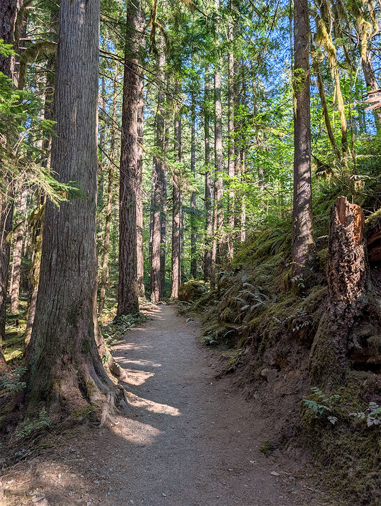
I read that Twisp was an arts hub. But unfortunately, there were no overt signs of anything arty when we visited. We walked a trail along the Methow River, looking for wildlife, and then wandered into downtown. Main Street was torn up with construction. We decided to head on to our next stop.

Winthrop
Winthrop is an old-west-themed town. We stopped at the grocery store on our way in, and I was impressed with its old-timey facade. I was kind of excited to walk the streets of the town. But when we got there, it was a bit of a disappointment. Yes, everything was rustic-looking- even the trash receptacles- but inside, the stores sold the same old uninspiring tourist swag. And because of all of the street parking, the town didn’t make very good pictures.


Pearrygin Lake State Park
We used our Washington Discover Pass to visit Pearrygin Lake State Park just outside of Winthrop. We hiked a trail on a bluff overlooking the park for a view of the lake and the hazy Cascades. Wildfires were growing by now, and we often had hazy views.

Methow Community Trail in Mazama
The next morning we headed up the road to the town of Mazama for a little hike. We detoured off the highway to a little side road where we saw a bear! Woo hoo! Things were getting exciting now. Our hike on the Methow Community Trail took us to a suspension bridge. Along the way, I marveled at the tall trees. We encountered large blocks that looked like a disassembled wall, stacked along the trail. Many of the blocks had relief murals. We walked across the suspension bridge and the Methow River and turned back to head to our next stop.


Washington Pass Observation Site
As we traveled westward along the North Cascade Highway, the mountains got taller and pointier. I tried to keep the pointiest ones in my sights. But soon they would be looming over us. We pulled off at the Washington Pass Observation Site. I thought that this would just be an overlook, but it was actually a nice, developed trail to several overlooks.


Diablo Lake
In no time, we were in the North Cascades National Park. Our first stop was the Diablo Lake overlook. Truly amazing. We looked out over vibrant blue water, green rolling hills, and snow-capped peaks. It was a crystal clear day. We wouldn’t be so lucky the following day.
After viewing the lake from above, we drove down to the lake level for another view. It wasn’t as impressive from the ground, but we did get to drive over a dam – which I thought was fun.


From the lake, we headed to the visitor center, where we watched the park movie. Whenever a visitor center has a movie, we always watch it. It is a great way to learn about all the places you will never go and all the things you will never do in the park. The North Cascades NP is about 789 square miles, most of which is wilderness. There are numerous backcountry hiking trails. It is home to 300 glaciers and has peaks over 9,000 feet in elevation. We weren’t going to be scaling any peaks, and we were only up for short trails at that time. In fact, we had already passed a few nice-looking trails to beautiful lakes.
We hiked a few short trails around the visitor center and called it a day.
Thunder Knob trail
The next day we were back at Diablo Lake to hike the Thunder Knob trail. We went into the woods and up to a cliff. The view of the lake was obscured by smoke. We were so glad we had seen it the previous day.

Baker Lake and Mount Baker
After the trail, we continued east on the Highway for 40 miles to the town of Concrete. We turned right and headed about 20 miles north to Baker Lake. Along the way, I could see a white-capped peak in the distance. It was Mount Baker, an active, 10,781-foot glacier-covered stratovolcano (cone-shaped volcano). Mount Baker loomed over us at our campsite at the lake. Google Maps showed a viewpoint for it up in the mountains adjacent to the lake. I really wanted to get an unobscured view of the peak. So when we left our campsite, we followed the map up into the hills. The road was rough; it narrowed and got rougher. It was a smoky day, and when we stopped short of the overlook, we couldn’t see anything in the distance. We decided to abandon the journey and turn around.


Back on the North Cascade Highway, we continued westward into civilization. We left the highway. But we would jump back onto the loop and the highway soon and experience another iconic part of Washington State, Puget Sound.


I bet the weather is wonderful right now, mild days and cool nights? The pictures are incredibly beautiful. We’re heading out of the 104F heat tomorrow morning for SMA. Have fun!
Yes, it has been very nice here in Washington. Some days we are actually kind of cold. I can’t believe it is 104 there! Hopefully, San Miguel de Allende is much cooler. I never remember being very hot in Mexico. But, of course, we always traveled there in the winter. Have fun in SMA!
I’m so sorry to read about all the smoke. Not only the obstructed views, but the smoke would also bother me. I’m glad you got to see the pretty lake and the snowy peaks. We visited North Cascades NP one summer, when we had to skip Glacier NP because it was surrounded and half inaccessible due to wildfires. North Cascades was a nice surprise and, back then, we even found some free camping in the area. I’m sure that scenic drive was worth it!!
We are out of the smoke now. But I have seen many people wearing masks. It seemed like all of Washington was on fire at one point. I don’t think we have ever traveled anywhere in the US where there were so many wildfires. There was some free camping, but these days we are just looking for the easiest place to get to. We camped at the visitor center one night. It was so nice that this was allowed. The next night we went into the forest. Most spots were picked over, and we would rather not stay in a crappy spot, so we went to a campground. The day we drove up to the mountain to the overlook, we saw lots of nice open spots in the forest. I guess people just didn’t want to drive that far on a crappy road to camp.
We usually base in Winthrop for this same stretch of Highway 20. Filling up groceries before Mazama is worth it; options thin out fast once you head west toward Washington Pass. On summer weekends the Blue Lake trailhead lot fills before 10am, so we treat the overlook as Plan B if parking looks hopeless. Pearrygin with the Discover Pass is a solid low-key afternoon when the high country is smoky, which matches what you ran into on Thunder Knob.
Thanks for the suggestions. I think Blue Lake was full when we passed by. We were looking for shorter trails anyway. The Discover Pass was such a deal! We really enjoyed being able to visit all the state parks, and we also enjoyed some free camping with the pass.